Mashkan-shapir Iraq |
Images
click on the images to enlarge
Detail of the surface at Mashkan-shapir showing both artifact scatters and traces of subsurface architecture; photo © 2004 Elizabeth C. Stone; used with permission. |

View across the site (with a person for scale) taken during the surface survey undertaken in the late 1980s, showing the general topography and artiact scatters found in the region; photo © 2004 Elizabeth C. Stone; used with permission. |
 Closeup detail of the surface at Mashkan-shapir showing the density of the artifact scatter; photo © 2004 Elizabeth C. Stone; used with permission. |
Renders
| click on the image to enlarge |
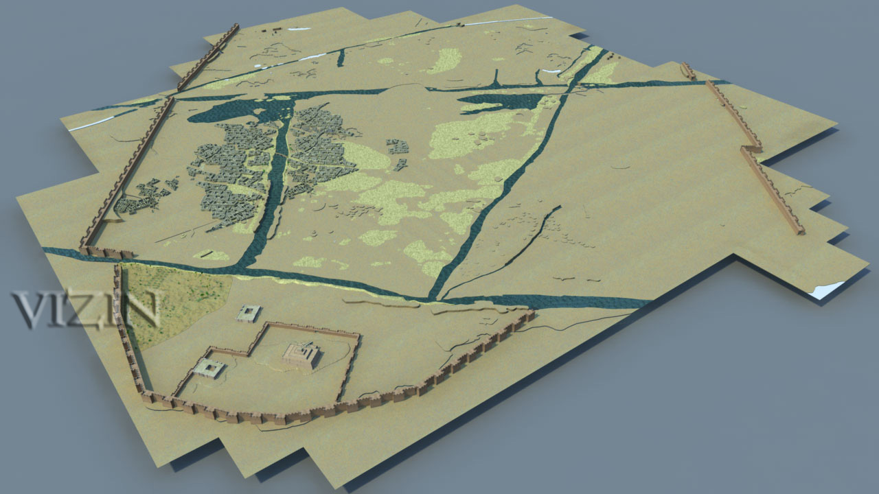
Aerial rendering from the virtual reality model of the city showing the major districts (religious, administrative, domestic, industrial, and garden) each bordered by canals; preliminary status model by VIZIN. |
Interactive
|
Typical aerial view of a 1-hectare square section of the site (with the corresponding site drawing underneath showing features, artifact scatters, and architecture); photo and drawing © 2004 Elizabeth C. Stone & Paul Zimansky; extracted from their book The Anatomy of a Mesopotamian City; used with permission. |
VRML (3D viewable)
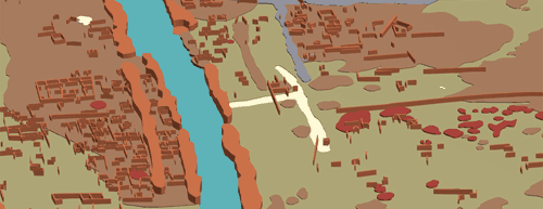
Screen grab from our virtual reality massing model of the city showing some of the major features (canals in blue; embankments in thick terracotta, misc. walls in brown, roads and alleys in white or light blue, and artifact scatters and low mounds in light brown). |
Reference
Page Created: October 5, 2004
Page Updated: January 2, 2012
URL:
Page Author: The Institute for the Visualization of History